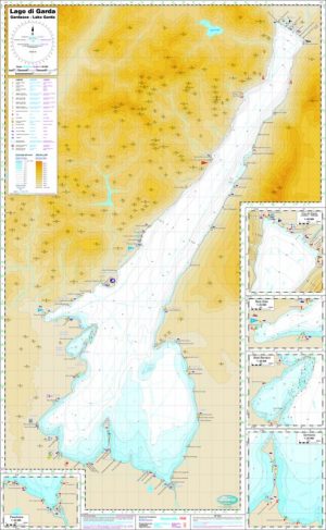
Nautische Seekarte Gardasee 1:50.000 – Foliendruck

58,50 €
zzgl. Versandkosten
Nautische Karte des Gardasees im Maßstab 1: 50.000, 4-farbig, mit 5 Detailkarten.
Mappa nautica del Lago di Garda, scala 1:50.000, contiene cinque piante dettagliate.
Nautical map of Lake Garda in scale 1: 50,000, with 5 detailed plans.
Wasserfest – impermeabile – waterproof
Beschreibung
Gardasee Binnenseekarte für Wassersport + Berufsschifffahrt. Nautische Karte des Gardasees im Maßstab 1: 50.000. Die Karte wurde zwischen 2011 und 2014 mit den neusten Vermessungsdaten der Seetiefen und Uferregionen erstellt. Sie enthält 5 Detailpläne, ein Notfall-Meldesystem zur vereinfachten Standortsbestimmung und alle wichtigen Details für den Wassersport. Ausgabe 2015
Mappa nautica del Lago di Garda, scala 1:50.000. La carta è stata redatta tra il 2011 e il 2014. Contiene cinque piante dettagliate, un sistema di emergenza per la determinazione semplificata della propria posizione e tutti i dettagli importanti per lo sport acquatico. Edizione 2015
Nautical map of Lake Garda in scale 1: 50,000. The map was created from 2011 to 2014 with the latest survey data of the depths and shorelines. It contains 5 detailed plans, an emergency notification system for easy positioning and all important details for water sports. Edition 2015
Ungefaltet – Spiegato – unfolded: 110 x 70 cm
Wasserfest – impermeabile – waterproof
Weitere Karte Gardasee:
Ähnliche Produkte
-
Nautische Seekarte Gardasee 1:50.000
29,50 €zzgl. Versandkosten
In den Warenkorb -
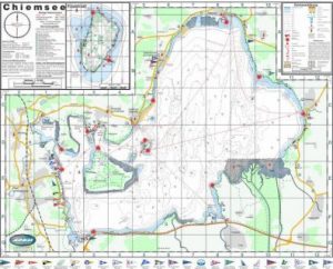
Nautische Seekarte Chiemsee 1:40.000 – Foliendruck
36,00 €zzgl. Versandkosten
In den Warenkorb -
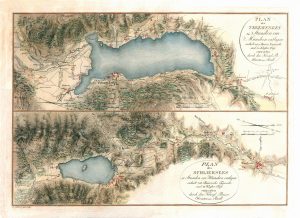
Historische Tegernsee und Schliersee von 1809, (Adrian von Riedl)
36,00 €zzgl. Versandkosten
In den Warenkorb -
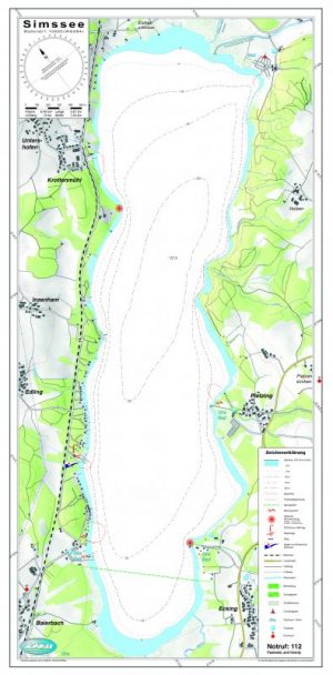
Nautische Seekarte Simssee 1:10.000
22,50 €zzgl. Versandkosten
In den Warenkorb